For our trip to the Peak District, we bought a book of walks to follow, instead of just meandering around the place. The walk we did on Saturday was actually a combination of two allegedly two or two and a half hour walks that made kind of a figure eight. The first half of the walk was called Padley Gorge, and the book told us to start at the Longshaw Estate visitors' area, a bit of a drive away from our cottage.
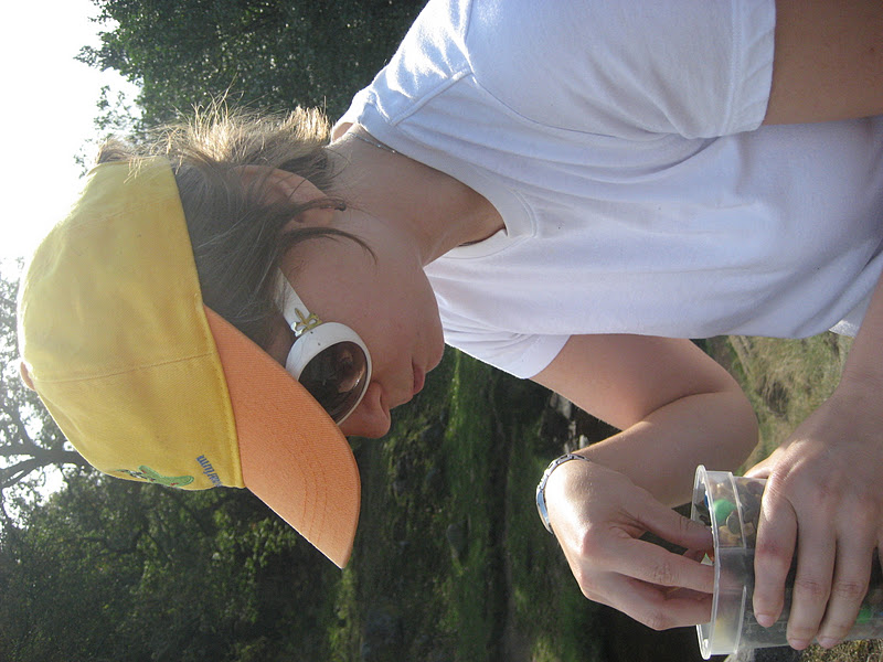
Here's me showing the requisite excitement in the parking lot (car park) just before we started off.

There's no picture of this of course, but as we were walking on a path away from the parking lot, there was a little three or four year old girl who had lost control of her Hello Kitty beach ball, and it was rolling just slightly faster than she could run. As she ran somewhat futilely after it, she kept going, Wait, Kitty, wait for me, and it was funny. I saw that the ball was approaching the danger of falling into a ditch ahead, so I stopped it and gave her back the ball, to her kind of surprise and possible dismay.
Crisis averted, we had to walk across the estate and cross a minor highway (B road) to get to the gorge, and we saw some sheepies along the way.


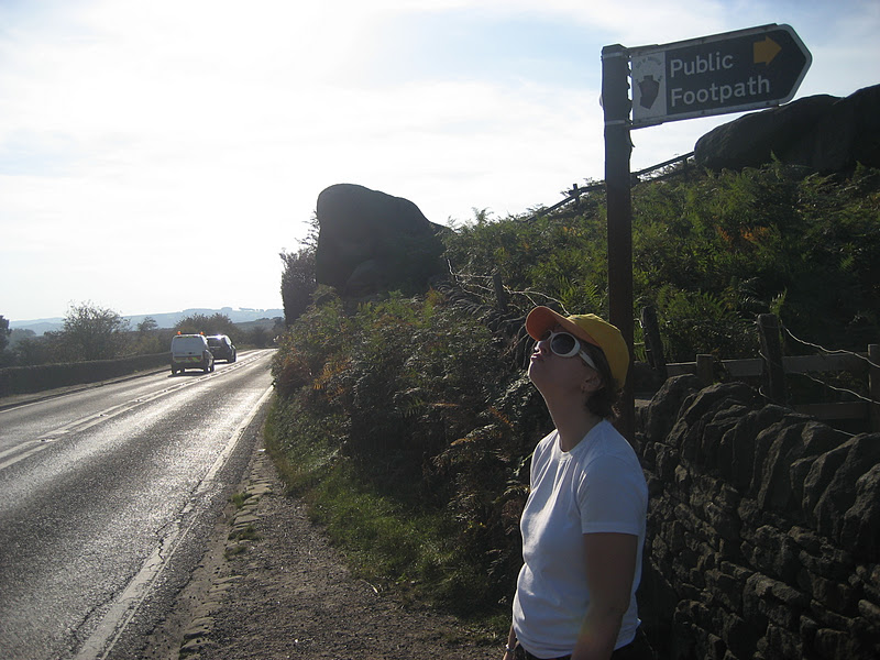
I've enlarged this photo so you can kind of make out what I'm smacking my forehead about. The sign says "FOOTPATH" and it's got arrows pointing both directions. Just roll that around the ol' noggin for a sec.

I think what we might be looking at here is the area above the little crick we had to cross once we got over the highway.

Then we took a trail mix break. I made really good trail mix. We still have some, which I have cleverly hidden from Ed in his kitchen so he won't eat it pounds (450g) at a time.
I don't know why we didn't take any picture of that little crick. It was cute, and there were kids playing in it and stuff, and families picnicking all around. Anyway, we finished our quick break and got into the wooded area that comprised much of the walk.

You can see the drop-off down to the gorge. In some places it was quite steep and the water was really far down. I guess that's a gorge for you.

Apparently we didn't take many pictures in there, because now we're across the gorge and crossing over a train station. You know what trees look like, though.


We went back into some trees after passing the station and crossing a little road, climbing up a steepish path, and then taking a little break by a fresh stream. I washed my face in the stream, but Ed seems to think nature is dirty.

Then it all opened out into a big field. This picture is what was off to one side, I think.

Once in the giant field, we used the ol' compass that my dad gave me ten years ago to figure out which way the guidebook wanted us to go. We found some lost strangers who were actually doing the same walk we were, and guided them to the next path. Sometimes these things will just be like, "Follow the footpath to the tree," but there are ten footpaths and five thousand trees. But we figured it out no problem.

Then we hit the pastures that we'd seen at the beginning of the walk, which took waay longer than the book said, even when we subtracted the approximate amount of time we spent sitting down and eating trail mix, stopping to look at something, and consulting the compass.

By now it was lunchtime, so we got our sandwiches and salad from the car and got a coffee at the Longshaw Estate's cafe. The next walk was called Carl Wark and Higger Tor, which, because I'm an r-pronouncing American, sounds like a frigging nightmare coming out of my mouth. This was the reason we chose to do this walk, despite closer ones available, just because it sounded funny to me. I think I'm pronouncing "wark" wrong, though, which contributes. I'm making it rhyme with "stork" when it probably sounds more like "bark." Anyway, what is a wark? And for that matter, what is a tor? This walking book has a lot of unfamiliar words. I'll get to that later.
For this walk, we started by finding and crossing a little Burbage Brook and going onto the highway, possibly a different highway, though.


Then we had to find a footpath that came after a rock called Toad's Mouth Rock. You can't really see the detail of the rock here, but there's actually a line that kind of looks like the toad's mouth. The silhouette here is kind of toady, and don't forget to admire my excellent toad's mouth impression.
The problem with the guidebook, as I mentioned above, is that it wasn't always very specific, and there was often a lot of guesswork involved, like finding the right path after the toady rock. The sign in the picture does not point to the footpath that the book wanted us to use, and I think we may have sort of arbitrarily chosen another footpath later, just because we couldn't find the stone stile landmark we were looking for. In retrospect, maybe we should have taken that first path.
Once we found a path that looked sort of right, we followed a nice grassy line across part of the heather-filled moor.


There's a little cave down there.

But then after a while, the path sort of disappeared, and we had some problems. We couldn't find a proper path towards the next big landmark, which was Higger Tor (or Carl Wark, jeez, I don't remember which one), so we were kind of fricken fracken through the bracken, wending our way onto what looked like paths, but which would turn out not to be, getting our feet a bit wet, and having to walk really exaggeratedly because the grass was so tall. The compass really came in handy here, because we at least knew we had to keep going north, according to the map. Thanks, dad.
Here's a picture to show our sort of fatigue and uncertainty.

Eventually we found a well-worn dirt and rock path, which was only well-worn because so many people went down it a while, found the dead end at like a swamp or boulder or something, and turned back, making double the tread. Eventually we did get onto a path that led us to the base of Higger Tor. A tor, like most of the unfamiliar words in the guidebook, is some kind of big hill--in this case it's a big hill with rocks all over it.


We climbed to the top and it was like leprechaun land or something. I had a little resty with a nice rock under my back.


I climbed up this rock, but because I'm kind of afraid of heights, I didn't get to the very top. Danger, Will Robinson.


This is underneath the too-tall rocks. Nice hair.


I shouldn't need to name this poke anymore.


Okay, so we climbed down Higger Tor and went over to Carl Wark, which appears to be some sort of fortified perimeter atop the hill. The sign says it's a hill fort from the Iron Age.

On the way down from Carl Wark, we saw these two rams (there were tons of sheep just hangin' around the moor, by the way), and they looked like they were having territory issues and were freezing and generally acting strangely.

At first we thought they were having some territory issue and maybe they were going to do some sort of exhibition or fight or something, but then we figured out that it was our presence that was bothering them. So we moved on.

There was a tiny stream to cross, and it seemed best to take my shoes and socks off and wade (paddle) through it. I think my feet were quite hot by then. Getting delayed on the moor made us kind of have to hurry back. I think we even cut the official walk short and took the most direct path back to Longshaw so we wouldn't be wandering about in bracken and heather when the sun went down.


This is a bench made so homeless sheep can't sleep on it, just like in LA.

The sun was setting by the time we got back to the car. It was a long day of walking, and we were very tired.

The End.
No comments:
Post a Comment